Malta Announces €2.8 Billion Light Rail Project: Airport to St Paul's Bay by 2041
Malta's Transport Ministry announced Thursday a €2.8 billion light rail project connecting the airport to St Paul's Bay, marking the island's largest infrastructure investment in decades. The 24-kilometer line will reshape how residents and visitors travel across the island, addressing decades of congestion and car dependency. The project, unveiled on Thursday, 23 April 2026, spans 15 years with construction projected to begin in 2031.
What Residents Need to Know Now
Timeline:
• 2026–2027: Technical studies and feasibility phase
• 2027–2029: Detailed design and planning
• 2029–2032: Environmental approvals and procurement
• 2031: Construction begins
• 2036–2039: First section (airport-to-Valletta) enters service
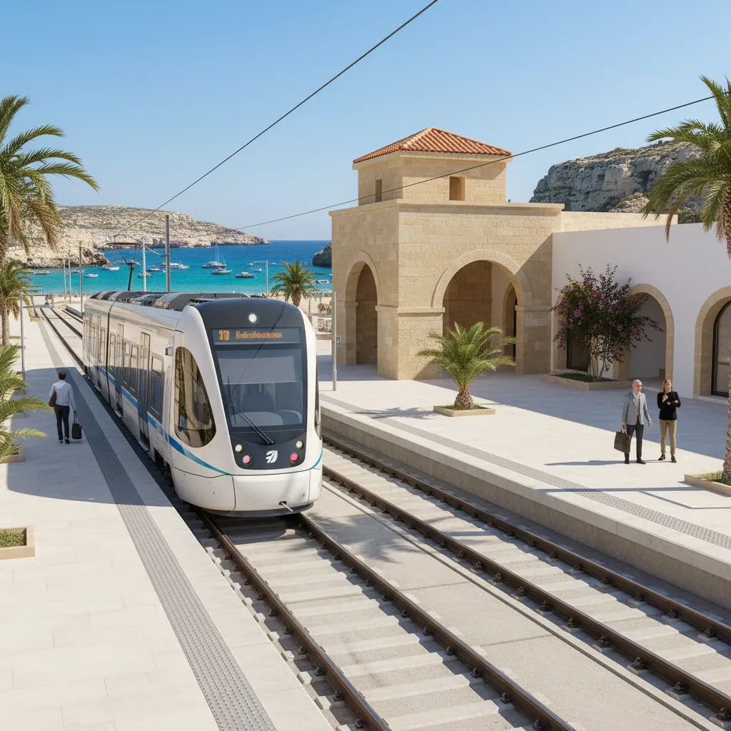
• 2041: Full line to St Paul's Bay operational
Areas Most Affected by Construction:Valletta, Qormi, Birkirkara, Mater Dei hospital precincts, and St Paul's Bay will experience construction activity throughout the building phase. Underground excavation in Valletta and complex areas will require street closures and utility relocation. Elevated sections elsewhere will involve temporary crane operations and noise across multiple months per station.
Bus Network Changes Coming:The current Malta Public Transport concession expires in 2029, triggering a complete redesign of bus routes. The new operator will restructure services into three tiers: primary routes with dedicated lanes on high-demand corridors, feeder buses directing passengers to rail stations, and local neighborhood services. Exact frequency increases and route changes will be finalized during the design phase but will shift from direct central-area routes to a hub-and-spoke model feeding the light rail.
Parking and Vehicle Access:The government has committed to building residential parking facilities in Qormi, Birkirkara, and Ħamrun, recognizing current on-street parking consumes valuable public space. Park-and-ride facilities near light rail and major bus stations will encourage drivers to use peripheral parking and transfer to public transport. However, the government has ruled out introducing on-street parking fees in central areas—a political decision that means paid facilities will be optional rather than mandatory, limiting how significantly traffic patterns may shift.
Fares:Whether the light rail service will remain free—as Malta's current buses are—has not yet been determined. This decision will be critical for adoption rates and will be finalized during detailed design phases.
Why This Project Matters
Malta's transport network faces capacity challenges. Over 250,000 people board buses daily on a network designed for roughly half that volume. St Paul's Bay funnels visitors and commuters through corridors barely accommodating existing traffic. The airport corridor—linking the nation's economic gateway to urban centers via a single congested route—typifies the structural weakness. When tourist season peaks or unexpected disruption occurs, gridlock becomes endemic, productivity plummets, and air quality metrics spike across residential zones.
The "Malta in Motion" strategy treats transport not as disconnected projects but as an integrated system. The light rail acts as the foundational spine; buses evolve into feeder networks; ferry services expand to distribute load across water corridors; cycling and walking infrastructure claims public space currently dominated by parked vehicles. This represents a philosophical departure from decades of incremental road-widening and bus service adjustments.
How the Light Rail Will Work: The Hybrid Model Explained
The original 2021 underground metro proposal demanded €6.2 billion and excavation of roughly four million cubic meters of material—a scale that exposed logical flaws in designing underground infrastructure for a densely settled, archaeologically complex territory. Every excavation bucket risked striking Neolithic settlements, medieval fortifications, or Ottoman-era sites. Delays measured in years and budget overruns were probable.
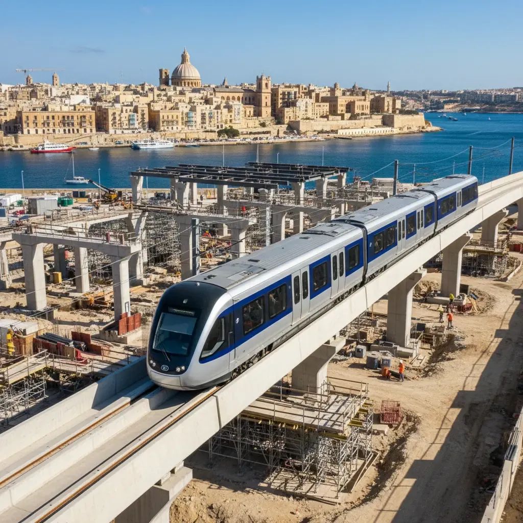
The redesigned "La Valette line" accommodates three construction typologies: underground sections in heritage-dense precincts like Valletta where surface infrastructure is impossible; elevated monorail segments where topography permits and road width is minimal; at-grade stations in peripheral zones where space exists and archaeology is less fraught. This segmentation reflects engineering pragmatism rather than compromise. Elevated rubber-tyred systems operate quietly and demand minimal land acquisition in congested towns. Underground tunneling concentrates where surface alternatives are genuinely impossible, not merely inconvenient. At-grade work proceeds where operational and environmental advantage exists.
Why This Project Costs €2.8 Billion
At €130M–€150M per kilometer, Malta's project sits in the upper-middle range of Southern European comparables. Labor expenses in Mediterranean economies outpace Eastern European benchmarks; heritage protection regulations impose compliance costs that Nordic projects bypass; Malta's water table and limestone geology complicate deep tunneling; procurement across a small market offers fewer competitive alternatives.
The 40–45% contingency buffer embedded in the €2.8 billion figure signals institutional awareness that cost surprises are probable. Expressed in practical terms, each kilometer will consume roughly €5M per month over its seven-year construction window—a substantial commitment for a nation of 520,000 people.
Construction Disruption: A Realistic Timeline
For residents in Valletta, Qormi, Birkirkara, Mater Dei precincts, and St Paul's Bay, construction will alternate between normalcy and disruption in patterns difficult to predict precisely. Underground excavation demands street closures, utility relocation, geological surveys, and vibration monitoring in already congested areas. Elevated sections require tower construction, crane operations, and noise spanning months per station. At-grade work means machinery, dust, and periodic access restrictions.
The government's "Malta Vision 2050" framework commits to "empowering local authorities to monitor and coordinate construction sites, minimizing citizen disruption"—language signaling recognition of past project friction. Whether coordination materializes operationally remains uncertain given historical patterns of road works, utility upgrades, and harbor developments routinely exceeding schedule.
Archaeological complications pose the most substantial temporal risk. Malta's terrain contains Neolithic temples, medieval fortifications, Ottoman-era structures, and paleolithic deposits. Excavation in Valletta, Mater Dei precincts, and university zones risks uncovering heritage sites triggering costly rerouting, extended review, or project segment suspension. A single major discovery could add years to construction and hundreds of millions in expense.
Environmental Impact
Once operational, the light rail offers genuine environmental benefits. Projected 30% increases in public transport ridership and 25,000-ton annual CO₂ reductions would meaningfully address Malta's transport-driven air quality challenges. Valletta, the airport zone, and St Paul's Bay suffer elevated particulate matter and nitrogen oxide concentrations exacerbated by vehicle congestion. Relieved road traffic would lower ambient pollution and improve respiratory health across the urban population.
The construction phase presents the inverse picture. Underground excavation generates noise, vibrations, and waste streams compounding Malta's acoustic burden from road traffic and aircraft. Elevated sections require vibration isolation and operational noise management. Detailed environmental assessments underway will quantify construction-phase impacts, but preliminary analysis suggests disruption will be substantial in station precincts.
Ferry Expansion and Multimodal Transport
Ferry services complement the bus and light rail redesign. A new service connecting Sliema, Buġibba, and Gozo was set to launch imminently as of April 2026. A Marsascala route is under development. These maritime corridors offer genuine advantage: ferries bypass road congestion entirely and distribute demand across three transport modes. Tourism marketing benefits accrue as well; arriving at the airport and boarding a ferry to Valletta projects modernity rather than gridlock.
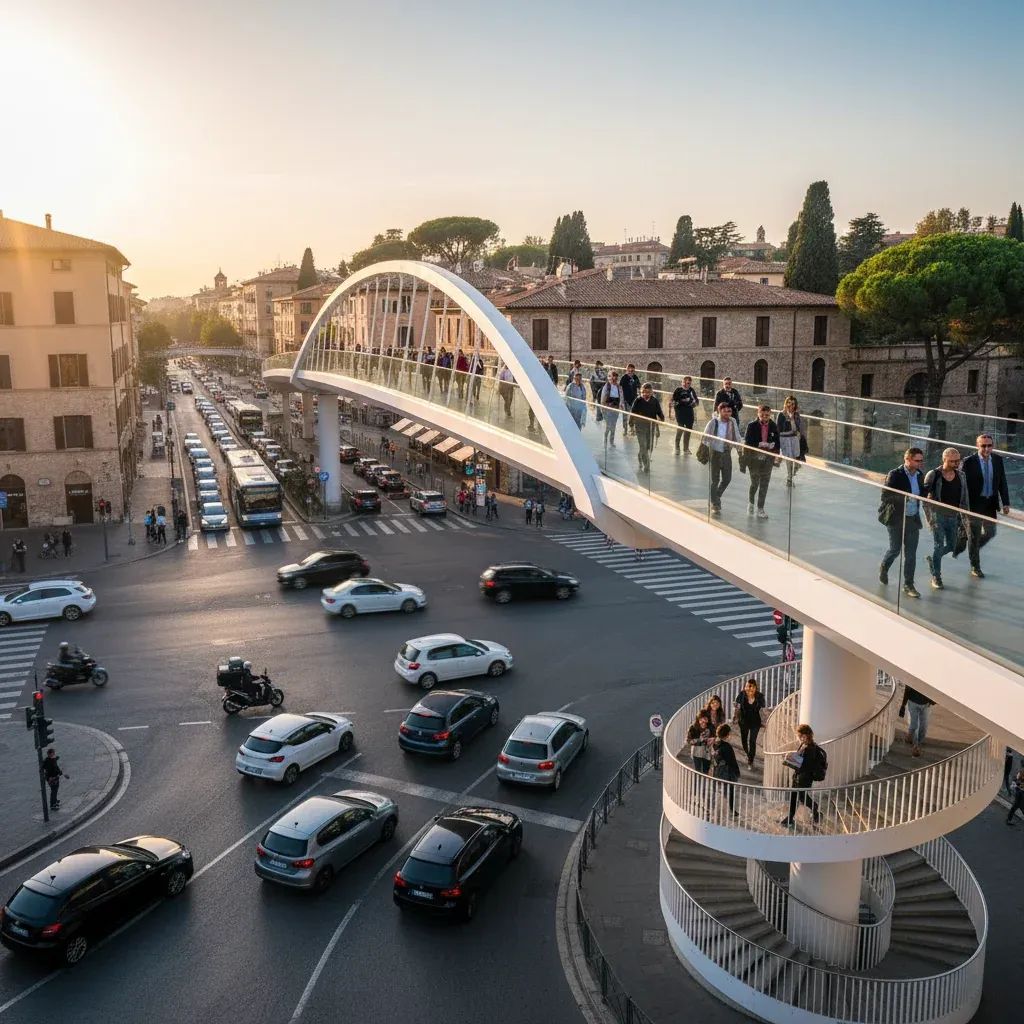
Active Transport: Walking and Cycling
Walking and cycling infrastructure improvements are explicitly prioritized. A long-promised cycling strategy is scheduled for imminent launch; specific allocation of road space to bicycle lanes, intersection treatments, and secure parking remains under review. Park-and-ride facilities near light rail and major bus stations will encourage drivers to abandon vehicles at peripheral sites and transfer to public transport for final-mile commuting.
Political Continuity and Implementation Risk
Both the ruling government and opposition parties have publicly affirmed willingness to forge a bi-partisan infrastructure pact, committing to project continuity regardless of electoral outcomes. Such agreements are rare in Mediterranean politics and historically fragile when fiscal pressures mount. If a future election coincides with a fiscal crisis or competing national priorities, will political commitment hold or will the project enter multi-year limbo?
The European Court of Auditors documented that major continental transport projects experience average delays of 17 years relative to initial timelines. Malta's proposal incorporates realistic buffering but cannot immunize itself against archaeological discoveries, political disruption, or fiscal crises that freeze project expenditure.
The Route: Why Airport to St Paul's Bay?
The La Valette line routing anchors to the airport as origin, traverses Valletta, Qormi, Mater Dei Hospital, the University, and terminates at St Paul's Bay. This reflects demand patterns: the airport generates consistent passenger flow; Valletta anchors employment and tourism; the university and hospital concentrate large daytime populations; St Paul's Bay represents tourism and residential growth. Secondary lines are theoretically possible but remain deferred; current plans focus on the primary spine.
Timing reflects confluence of factors: EU transport infrastructure co-financing availability, emerging political consensus, international consultant capability, and growing recognition that incremental road expansion cannot solve Malta's congestion challenge. The €2.8 billion investment represents approximately 0.6% of Malta's annual economic output committed over 15 years—substantial but manageable if project discipline holds.
What Happens Next
Residents requiring detailed information about construction timelines for specific neighborhoods, planned bus route changes, or project updates can monitor announcements through local councils and the Transport Ministry's official channels. The detailed feasibility studies currently underway will provide concrete information about which streets face disruption and when.
The light rail represents Malta's largest infrastructure commitment to transport in modern history. Whether execution matches ambition remains uncertain—but the commitment to confront congestion through multimodal integration rather than continued road expansion reflects acknowledgment that the island's current transport model is unsustainable.